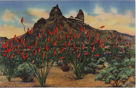
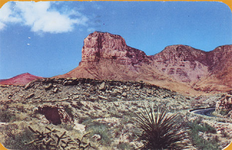
A vintage Big Bend National Park Series postcard from the year 1947. No. 208 - "Mule Ear Peak, Chisos Mts. Texas: Mule Ear Peak is a landmark in the (proposed) Big Bend National Park. This view is from the head of the Joe's Creek, with the colorful Ocatillo cactus and other desert flora in full bloom"
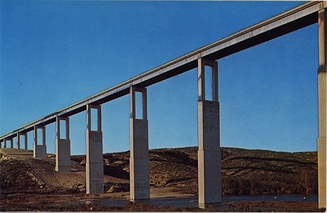
Devil's River Bridge, 1970 postcard. "U.S. Highway 90 between Comstock, Texas and Del Rio, Texas. Completed in 1965 this bridge won first place in its division of prize bridge awards granted by the American Institute of Steel Construction. Upon completion of Amistad Dam, water level should reach within 20 feet of the top."

1970 postcard, no. S-72275-1. International Amistad Dam "Twelve miles upstream on the Rio Grande near Del Rio, Texas. The dam is a joint project between the United States and Mexico and will be completed in 1969. The dam is a joint project between the United States and Mexico and will be completed in 1969. The dam will create a lake covering some 84,000 acres, 85 miles long. The dam will be 254 feet high and 6.5 miles long. The dam will also become a bridge with access to Mexico. When filled Amistad will become the largest lake in or bordering Texas."
Amistad Dam was completed on September 8, 1969 and the reservoir began to fill. At conservation pool capacities, Amistad Reservoir is the second largest lake in Texas, after Toldeo Bend and before Sam Rayburn. At water elevation of 1117 feet Amistad Reservoir has 65,000 surface acres of water, capacity of 3,159,270 acre/feet. Two thirds of the reservoir volume is in the United States.
"Travelers on Hwy. 90 cautiously drive across the Pecos River bridge spanning the spectacular Pecos River of West Texas. Pioneers experienced much difficulty in crossing it and Indians added danger to the perilous trip."
The Pecos River Bridge shown in this postcard was built in 1923 and was 50 feet above the water. It was washed away by flood waters in 1954. It was replaced in 1957 by a new high bridge that is 273 feet above the water.
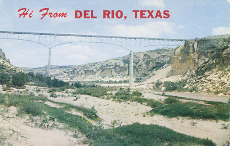
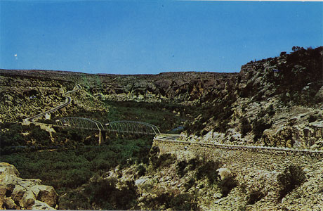
"PECOS RIVER BRIDGE. Pecos River high bridge located on U.S. 90 between Del Rio and Sanderson, Texas. This bridge is an engineering achievement of the Texas Highway Dept. Built at a cost of $1,250,000 it is 1200 ft. long and 280 ft. high. It is the highest bridge in Texas and ranks ninth in the nation."
High Bridge was completed in April 1957 and replaced the old Pecos River Bridge that washed away by flood waters on 1954.
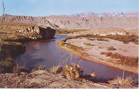
"WEST TEXAS -- The Rio Grande meanders toward the Sierra del Carmen and a spectacular canyon it has cut through these mountains in Big Bend National Park. The historic Comanche Trail crosses near the Mexican village of Boquillas shown in the distance above the Rio Grande." Card No. 93757, purchased June 24, 1970.
LANCASTER HILL. The ruins of Old Fort Lancaster are located at the foot of this hill. Camels were imported into this Fort from their native land. They tried using them but there were too many rocks in this country; it was too hard on their feet. Even today their bones are quite often found where they were just turned loose. Located on U.S. 290, between Ozona and Sheffield, Texas" Card No. 5-64190-2, purchased June 25, 1970.
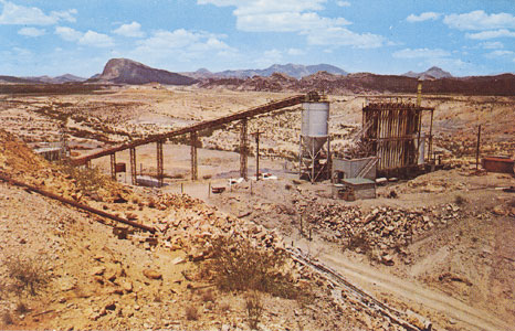
"Study Butte (former ghost town) Hwy. 118, Brewster County, Texas. A view of the cinnabar (mercury) mining active in the Big Bend country. Shown are the conveyor belt, storage bin, furnace and condensing tubes of the mining operation. In the background is Indian head mountain." Card No. 56400-C, purchased June 24, 1970.
"El Capitan and Guadalupe Peaks. Signal Peak, as El Capitan was called by early pioneers and stage coach drivers, rises to 8,078 ft. Guadalupe Peak beyond it is 8,751 ft. the highest point in Texas. Seen from Guadalupe Pass on U.S. Highway 62." Postmarked Jun 9, 1952.
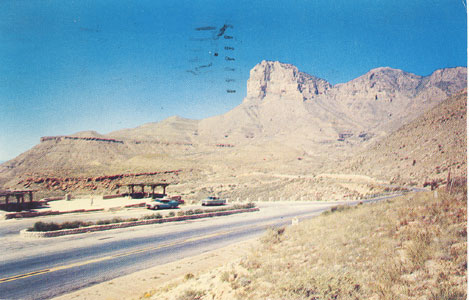
"El Capitan and Guadalupe Peaks. Signal Peak, as El Capitan was called by early pioneers and stage coach drivers, rises to 8,078 ft. Guadalupe Peak beyond it is 8,751 ft. the highest point in Texas. Seen from Guadalupe Pass on U.S. Highway 62." Card No. 53052. Postmarked July 4, 1958.
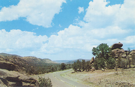
"West Texas -- The Davis Mountain scenic loop road through Texas Highlands is accessible from Van Horn, Balmorhea, Ft. Stockton, Marfa and Alpine." Card No. 1200-8, purchased June 25, 1970.
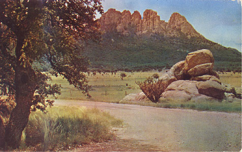
Sawtooth Mountain on Scenic Lloop. One of the Wonders of the Davis Mountains. Postmarked 1953.
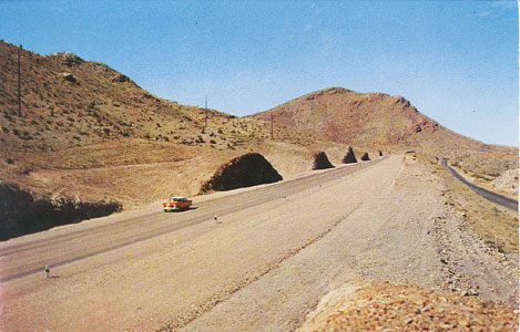
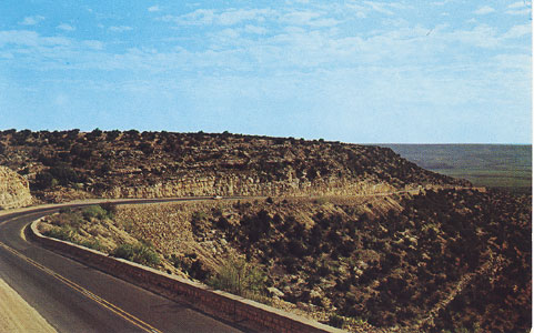
"The New U. S. 80 between Van Horn and Sierra Blanca, Texas. Highway U. S. 80, 'The Broadway of America,' is one of the finest coast-to-coast highways of America. this new stetch of road eliminates 37 curves and grade elevations in a distance of 10 miles." Postmarked December 29, 1958.

Copyright 2000-2007, Texas Water Towers Dot Com. All Rights Reserved.